connecting businesses in the state to the world.
Kano State is located in North-Western Nigeria. It was created on May 27, 1967 from part of the Northern Region bordering Katsina State to the north-west, Jigawa State to the north-east, Bauchi State to the south-east and Kaduna State to the south-west. The capital city is Kano.
The state originally included Jigawa State which was made a separate state in 1991. The total land area of Kano state is 20,760sq kilometers with a population of 9,383,682.
The Government
Dr. Rabi'u Musa Kwankwaso was elected governor of Kano from 1999 to 2003,
re-ellected on 27 April 2011 and sworn in on 29 May 2011 for a second term in office.
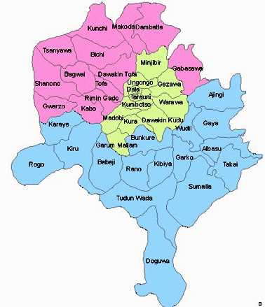
44 LOCAL GOVERNMENT AREAS
Kano state is divided
into forty-four local government areas which form twenty-four
federal constituencies and three senatorial districts.
LGA Name
Ajingi, Albasu, Bagwai
Bebeji, Bichi, Bunkure
Dala, Dambatta, Dawakin Kudu
Dawakin Tofa, Doguwa, Fagge
Gabasawa, Garko, Garun Mallam
Gaya, Gezawa, Gwale
Gwarzo, Kabo, Kano Metropolitan Area
Kano Municipal, Karaye, Kibiya
Kiru, Kumbotso, Kunchi
Kura, Madobi, Makoda
Minjibir, Nassarawa, Northern Kano State
Rano, Rimin Gado, Rogo
Shanono, Southern Kano State, Sumaila
Takai, Tarauni, Tofa, Tsanyawa
Tudun Wada, Ungogo, Warawa
Wudil
The People
The official language of Kano State is English but the Hausa language is commonly spoken. Kano State is a commercial and agricultural state known for the production of groundnuts as well as for its solid mineral deposits. The state has more than 18,684 square kilometres (7,214 sq mi) of cultivable land and is the most extensively irrigated state in the country.
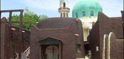
Tourist attractions include:
Audu Bako Zoological Garden, Dala hill
Emir's palace and its festivities, Falgore game reserve
Gidan makama museum, Kano city walls and gates
Kofar mata dyeing pits, Kurmi market
Kusalla dam and fishing centre, Rurum picnic site.
Tiga Dam and Bagauda lake hotels and resorts